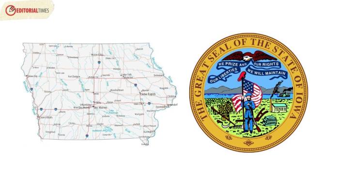
Full List of All Counties in Iowa
Iowa is divided into 99 counties. Below is a complete list:
- Adair County
- Adams County
- Allamakee County
- Appanoose County
- Audubon County
- Benton County
- Black Hawk County
- Boone County
- Bremer County
- Buchanan County
- Buena Vista County
- Butler County
- Calhoun County
- Carroll County
- Cass County
- Cedar County
- Cerro Gordo County
- Cherokee County
- Chickasaw County
- Clarke County
- Clay County
- Clayton County
- Clinton County
- Crawford County
- Dallas County
- Davis County
- Decatur County
- Delaware County
- Des Moines County
- Dickinson County
- Dubuque County
- Emmet County
- Fayette County
- Floyd County
- Franklin County
- Fremont County
- Greene County
- Grundy County
- Guthrie County
- Hamilton County
- Hancock County
- Hardin County
- Harrison County
- Henry County
- Howard County
- Humboldt County
- Ida County
- Iowa County
- Jackson County
- Jasper County
- Jefferson County
- Johnson County
- Jones County
- Keokuk County
- Kossuth County
- Lee County
- Linn County
- Louisa County
- Lucas County
- Lyon County
- Madison County
- Mahaska County
- Marion County
- Marshall County
- Mills County
- Mitchell County
- Monona County
- Monroe County
- Montgomery County
- Muscatine County
- O’Brien County
- Osceola County
- Page County
- Palo Alto County
- Plymouth County
- Pocahontas County
- Polk County
- Pottawattamie County
- Poweshiek County
- Ringgold County
- Sac County
- Scott County
- Shelby County
- Sioux County
- Story County
- Tama County
- Taylor County
- Union County
- Van Buren County
- Wapello County
- Warren County
- Washington County
- Wayne County
- Webster County
- Winnebago County
- Winneshiek County
- Woodbury County
- Worth County
- Wright County

Quick Facts
| Category | Quick Facts |
|---|---|
| Geography | Located in the Midwestern region of the U.S. |
| History | Became the 29th state of the U.S. on December 28, 1846 |
| Economy | Known for agriculture, particularly corn and soybeans, as well as manufacturing |
| Climate | Humid continental climate with hot summers and cold winters |
| Natural Attractions | Effigy Mounds National Monument, Loess Hills |
| Culture | Famous for the Iowa State Fair, caucuses, and a strong sense of community |
| Miscellaneous | State bird is the Eastern Goldfinch, State flower is the Wild Rose |
| Population | Approximately 3.2 million people as of 2020 Census |
| Notable People | Herbert Hoover, Donna Reed, Ashton Kutcher |
| Notable Places | Des Moines, Cedar Rapids, Iowa City |
| Bordering States | Borders Minnesota to the north, Wisconsin and Illinois to the east, Missouri to the south, and Nebraska and South Dakota to the west |
| Official Website | https://www.iowa.gov/ |
Related: Full List of All 50 States in the United States of America

